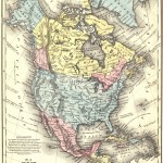
1858 Map of North America
1858 map of North America by Samuel Mitchell. Designed for students, the map is full of historical trivia and added details great for students of history.
A collection of over 4,755 free downloadable public domain images for crafters and web designers that have been rescued from old books, magazines, and other print materials. All of the images in this collection are copyright free in the United States and any country that extends copyrights up to 70 years after the death of the original artist making them in the public domain and free to use in your next scrapbook page, notecard or other craft projects.
This is one of several pages of vintage images for the image category Vintage Maps.
|
|
|||
|
1858 Map of North America1858 map of North America by Samuel Mitchell. Designed for students, the map is full of historical trivia and added details great for students of history. |
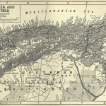
Algeria and Tunisia MapVintage Algeria and Tunisia map from when both countries were either owned or protected by France. It was included in an 1911 scholarly work. |
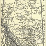
Alberta Canada MapVintage Alberta Canada map. This Canadian province was founded in 1906 and this map was drawn a few years later around 1910 or 1911. |
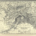
Alaska MapVintage Alaska map from an 1911 encyclopedia. The full state is displayed including the Aleutian Islands. |
|
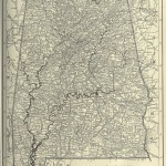
Alabama MapVintage Alabama map from 1911. Is your favorite city or town listed? There were half as many incorporated cities, towns and villages as there are now. |
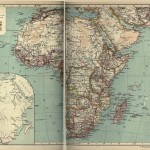
Africa MapIt is from a 1911 encyclopedia but the countries and political designations date all the way back to 1850 in this Africa Map from a well-known encyclopedia. |
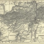
Afghanistan MapHistorical 1911 Afghanistan map from a public domain encyclopedia. There’s been a lot of changes to that part of the world since then. |
|
| ~~~ | |||