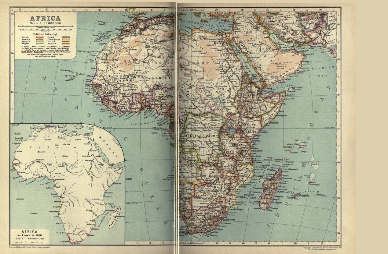
A lovely colored Africa map from an 1911 encyclopedia that covered two pages. It shows the various countries who owned/controlled various portions of the continent. Too bad the scan or the original print did not match the two halves of the country properly. I went ahead and put the two pages in one image but left a seam down the middle. Perhaps you could use one half or somehow camouflage that the two halves don’t meet.
I thought it interesting considering this 11th edition of the Encyclopædia Britannica, where so much time and effort was invested on creating a scholarly edition that one the map would be oddly matched and two it was already 60 years old at the time of publication.
This image is copyright free and in the public domain anywhere that extends copyrights 70 years after death or at least 120 years after publication when the original illustrator is unknown.