Maybe it’s just me or the fact that my family originated in Germany but there just seems something almost Old World and romantic about the Alps. They immediately bring to mind a certain style of homes, young boys in Leiderhosen, snow-capped mountain peaks, edelweiss and those long Alpine horns that are longer than the players are tall.
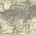
While we don’t see any of man’s influence, other than the naming of places, on this vintage map of the Alps, we do see is a massive mountain range that stretches from south-eastern France to the borders of Hungary. The Alps are not one continuous mountain but a series of ranges with deep valleys. They are the most important physical feature of the European continent. The 11th edition encyclopedia where this vintage map was found mentions that the name Alps is either derived from the Celtic root alb which means height or the Latin adjective albus or white – referring to the snowy peaks. Both work in my mind, high white peaks.
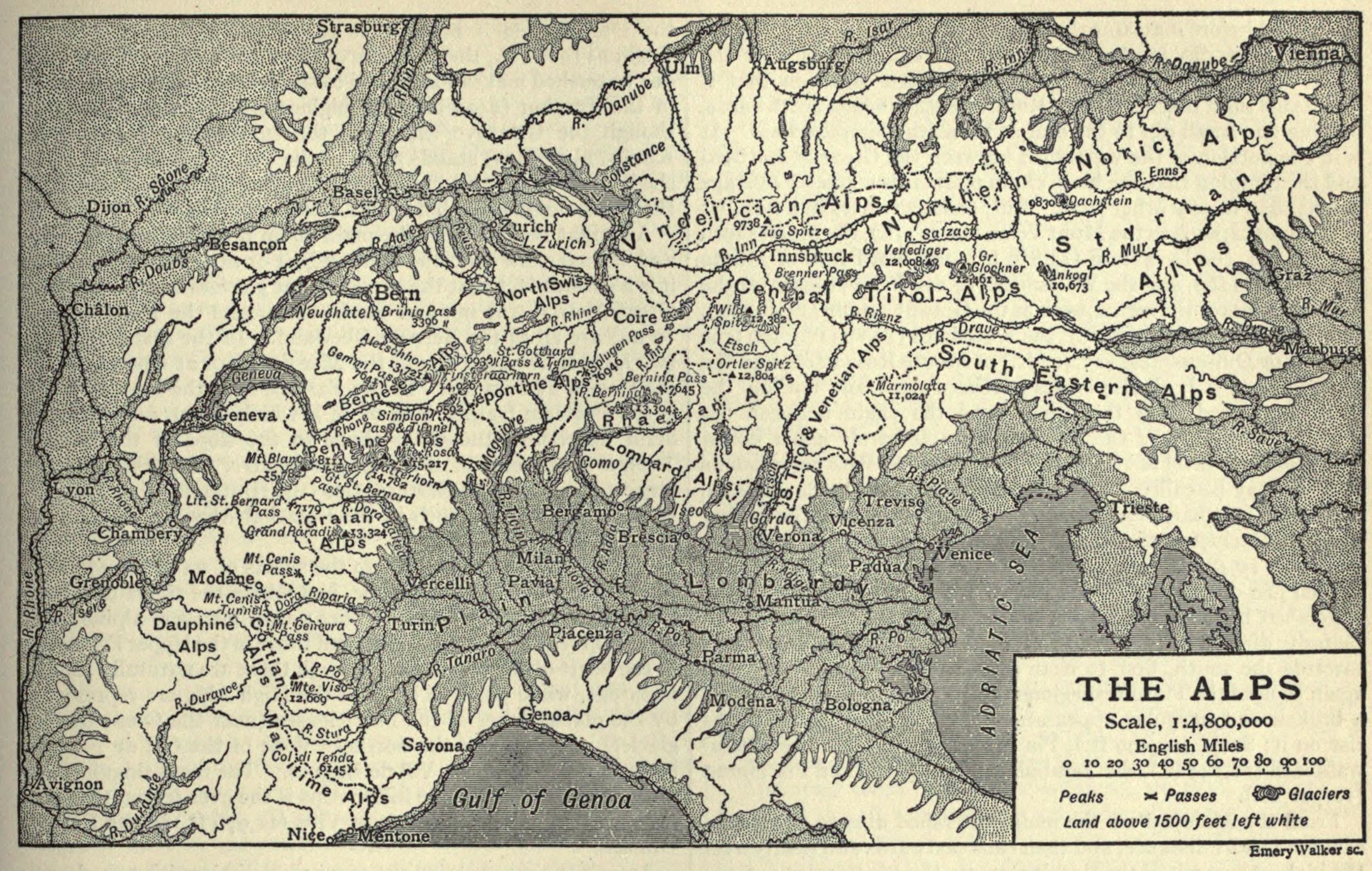
With a circa 1911 map, I’m sure there have been some name changes since it was published. None jumped out at me, but I’m sure this vintage map of the Alps has some hidden bits of historical interest here and there. After all, it predates both world wars. If you find something that’s changed that other’s might find interesting, please drop me a line so that I can share it with everyone.
This image is copyright free and in the public domain anywhere that extends copyrights 70 years after death or at least 120 years after publication when the original illustrator is unknown.