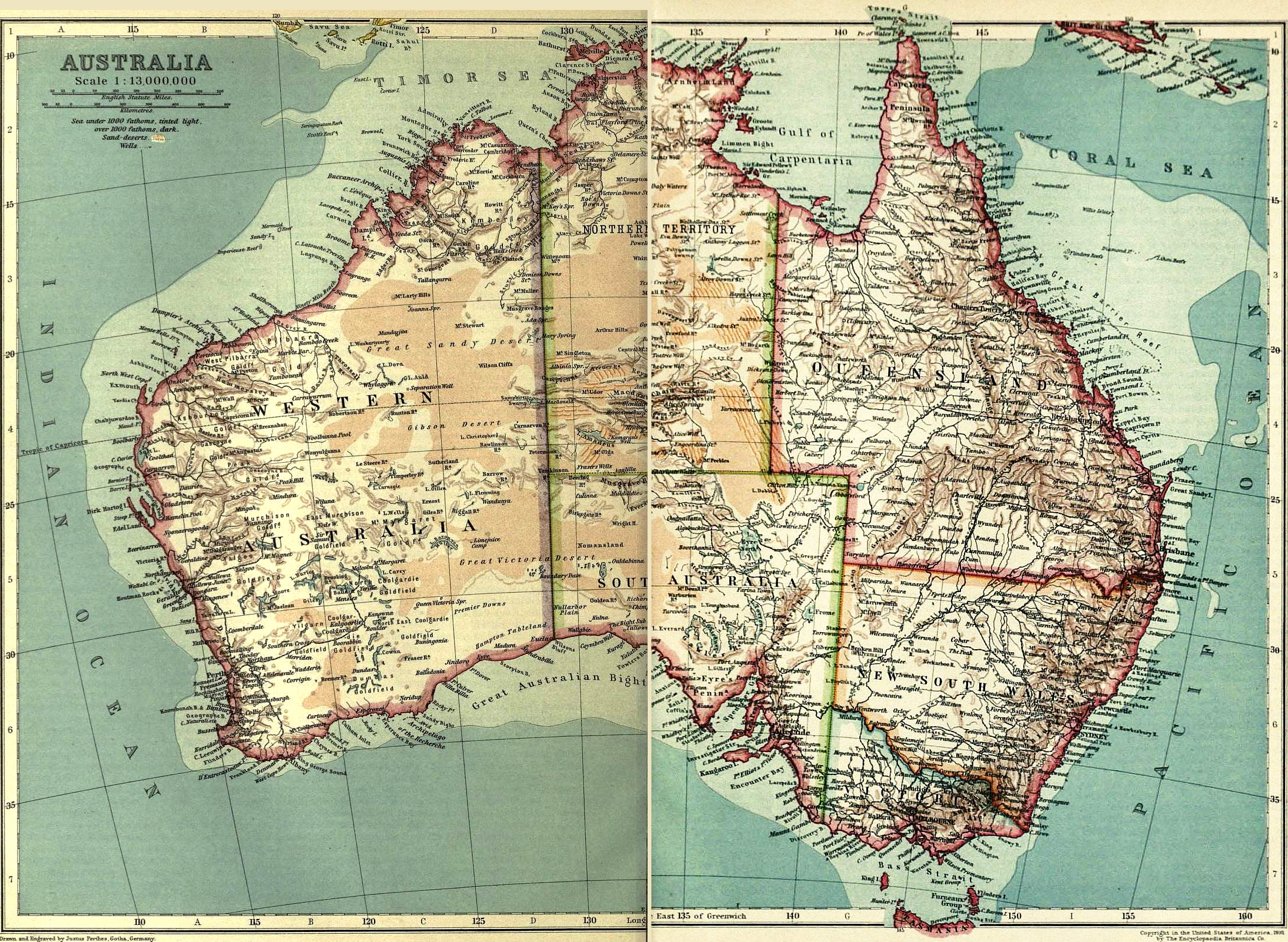
How far Australia has come from when this map was drawn. It was included in the 1911 Encyclopedia. Australia had only been an independent country since 1901. It wouldn’t be until 1908 that Canberra would be selected as the nation’s capital. But, while the capital was being constructed, it would be Melbourne that would function as the seat of government from 1901 to 1927. And, Melbourne is indeed identified as the capital on this vintage Australian map.
It seems a shame that American school children are not taught more about Australia. I remember it being lightly covered during conversations about our country’s founding. I think the biggest thing discussed was how we were both British colonies and how we were founded by people searching for freedom to practice their own religion and they were originally a penal colony. A shame really because the little I know now paints a vast country (it’s the 6th largest in the world) with a truly rich cultural heritage that goes far beyond what I was taught.
This vintage Australian map was published in two pieces on facing pages. Unfortunately, in what I would guess would be an attempt not to ruin the book binding, the left side of the scan is short some of the original map image. But, thankfully, unless you look really closely, it’s hard to tell. Though it is missing part of the TH in South Australia. I suspect for most folks that won’t be a super big issue but I did leave a small space between the two halves if you wish to play with this great full-colored map yourself.
The scan, while missing a little out of the center, is quite large. I’ve therefore displayed a smaller version below and you can view the full-version of this vintage Australian map by clicking on the image shown here.
This image is copyright free and in the public domain anywhere that extends copyrights 70 years after death or at least 120 years after publication when the original illustrator is unknown.