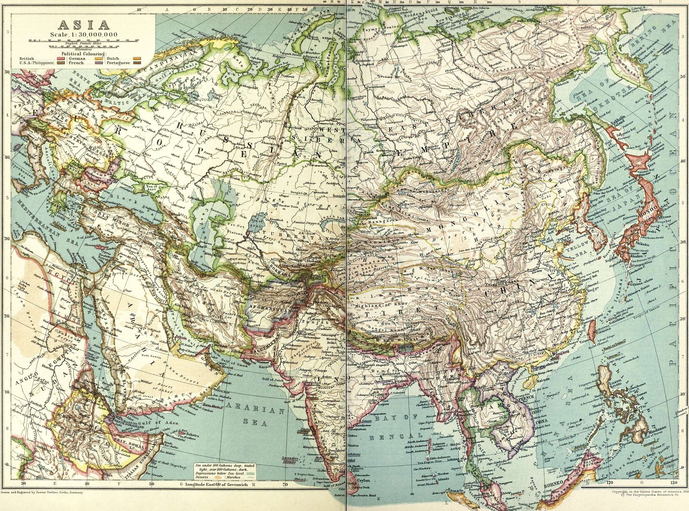
Stunning vintage Asia Map from 1910. There’s so much to talk about with this colorful Asia map. The colors are used to identify the “political” affiliations of each country. Another way to explain is that it identifies which countries are considered colonies of more powerful ones. What also makes this make interesting is how so many of the countries have new and different names from when this map was included in the 11th edition of the Encyclopedia Britannica.
Just a few of the changes in country names – Formosa became Taiwan, Siam would become Thailand, Asia Minor would become Turkey, and then there’s 15 countries that emerged from the Russian Empire when the Union of Soviet Socialist Republics dissolved in 1991. There’s several more but I’ll leave them to you to find.
What a fun home-school project this map could become. Studying how the countries once tied to each other are now still alligned, split or even now enemies. You could look up the capital cities identified on this vintage Asia map and see which ones have been renamed or moved. Home schoolers could study where countries have split from each other like the former Soviet Republics and North and South Korea. So much to do with such a great map!
The original map covered two facing pages in the encyclopedia. I have seamed them together into a single image. I’ve left it full-sized too! The image shown here is considerably smaller than the original. Just click on the Asia map below and you can view/download the original.
This image is copyright free and in the public domain anywhere that extends copyrights 70 years after death or at least 120 years after publication when the original illustrator is unknown.